
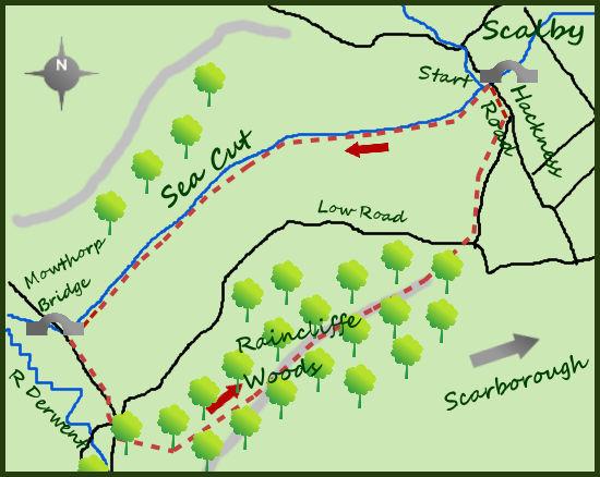
FOR those wanting an alternative to a beach walk at Scarborough, a walk along the ‘sea cut’ and return through the woods of Raincliffe makes for a fine alternative.
Hackness Road is the start of the walk, the lane lies off the A171, between Newby and Scalby. Approach the Sea Cut on Hackness road and on arrival turn left through a kissing gate at the sign for the Tabular Hills Walk.
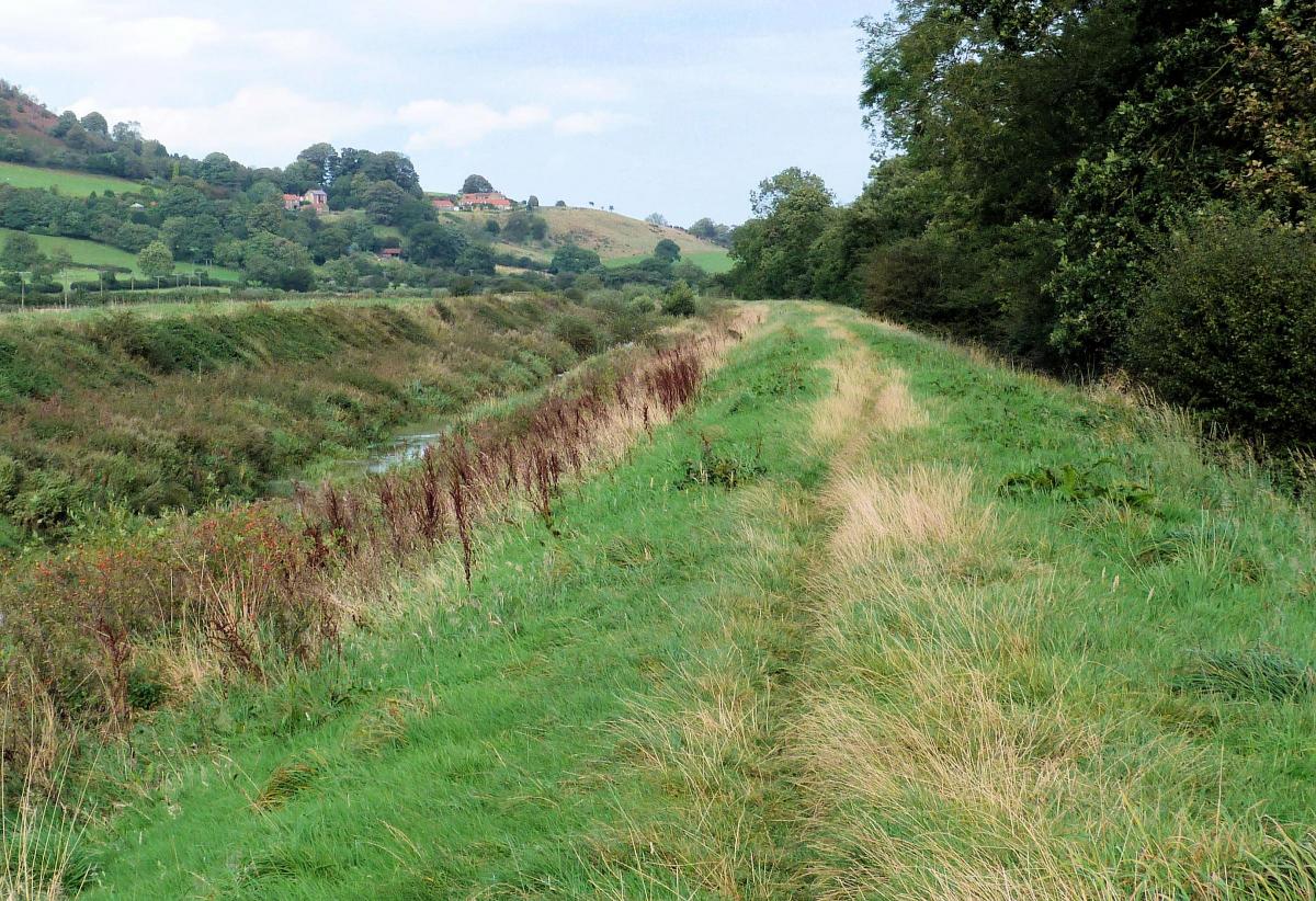
The Tabular Hills Walk is a 48-mile long-distance trail which completes the circle of its more famous neighbour, the Cleveland Way. It connects Scarborough to Helmsley and is lovely. This section is takes you alongside the Scarborough Sea Cut (Scalby Beck) for two and a half miles. Just keep the water to your right. Initially some trees and bushes obscure the water but soon you are walking in open land. This section that the walk goes alongside is man-made, although in reality it is an extension of the meandering Scalby Beck.
The cut itself was constructed in 1804 in response to serious flooding in previous years. It links the powerful River Derwent with a direct and safe route to the sea. The Derwent itself has many miles to go before it meets the Humber and the Victorians saw the sea cut as an option to reduce the damaging floods. Over the years the sea cut (with its powerful, controlled water supply) has been used to power mills and other industrial enterprises.
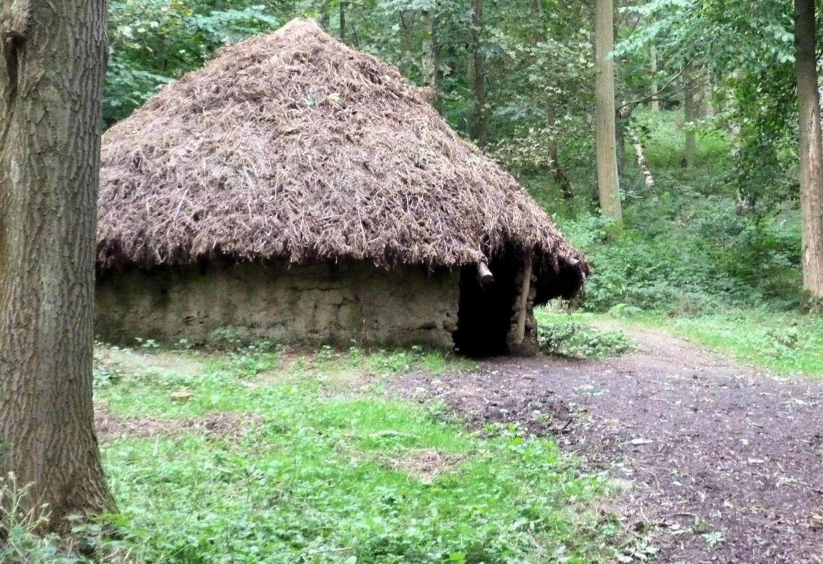
After two and a half miles, the path arrives at a minor road at Mowthorpe Bridge. Turn left and head south for half a mile to a T-junction. Here turn and look for the route opposite leading in to the woods. This bridleway leads through Raincliffe Woods. Although owned by Scarborough Council it is run by the Friends of Raincliffe Woods, a community group, who do an excellent conservation job. There are various events and projects that keep the woods busy but educational. Deer, badgers and foxes can be seen in the woods, the mixed woodland housing most native British species.
There is a large number of paths and marked trails, I took the bridlepath that climbs to start with and then contours the shallow hillside for over two miles until it emerges at some parking near Raincliffe Farm. On arriving at the road turn right and follow it for half a mile to an obvious left turn. From here continue north for a further half mile until it meets Hackness Road a few hundred metres from the Sea Cut and the start of the walk.
Fact Box
Distance: Roughly 6 miles
Height to Climb: 100m (328 feet)
Start: TA 011899. Park on Hackness Road or walk from nearby. The walk starts at the bridge.
Difficulty: Easy/Medium. Mix of riverside path, quiet lanes and woodland bridlepath.
Refreshments: There is plenty of pubs and cafes nearby.
Be Prepared: The route description and sketch map only provide a guide to the walk. You must take out and be able to read a map (O/S Explorer OL27) and in cloudy/misty conditions a compass. You must also wear the correct clothing and footwear for the outdoors. Whilst every effort is made to provide accurate information, walkers head out at their own risk. Please observe the Countryside Code and park sensibly.
Jonathan is the owner of Where2walk, a walking company based in the Yorkshire Dales:
• He has written 3 books on walking in the Dales; ‘The Yorkshire 3 Peaks’, ‘The Dales 30’ mountains and the ‘Walks without Stiles’ book. All these books (and more) are available direct from the Where2walk website.
• Book a Navigation (Map and Compass Skills) Training day near Settle or a bespoke day for a private group. The next available date is Sunday May 19th.
• Join our “Dales 30 Weekenders” in Hawes & Sedbergh.
Where2walk.co.uk also features 100’s of walks across Yorkshire and beyond, from easy strolls to harder climbs.


Comments: Our rules
We want our comments to be a lively and valuable part of our community - a place where readers can debate and engage with the most important local issues. The ability to comment on our stories is a privilege, not a right, however, and that privilege may be withdrawn if it is abused or misused.
Please report any comments that break our rules.
Read the rules here