
Jonathan Smith runs Where2walk, a walking company in the Yorkshire Dales.
Jonathan has written his own book, the Dales 30 which details the highest mountains in the Dales.
He also runs one-day navigation courses for beginners and intermediates. Join his Learn a Skill, Climb a Hill weekends in the Dales.
To find out more details on any of the above visit his website, where2walk.co.uk
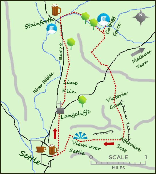
STARTING in Settle, this popular walk is full of interest and variety. Pretty villages and spectacular limestone scenery are the main features but there is also historical sites and two spectacular waterfalls.
From the main car park in Settle head through the central square and head up the lane next to the co-op. The lane bends left at the top end of Settle and contours the hillside for over half a mile. The views to the left to take in Giggleswick and the converted cotton mill of Watershed Mill. The lane ends at a busy road. After 150 metres turn right in to the lovely village of Langcliffe. A model village which grew up during the cotton boom it is worth popping in to St John’s Church.
Join the lane heading north but after 100 metres take the signed footpath across the fields.After passing over three stiles the path runs alongside the railway until arriving at the beautifully preserved Hoffman’s limekiln. The kin can be explored as a relic from the industrial past where limestone was burnt to produce purer lime for the surrounding fields and other industrial use. The path carries on north alongside the rail tracks till it meets the road, 150 metres shy of a second village Stainforth. A little larger than Langcliffe, Stainforth is equally pleasnt on the eye. If you have time cross under the road near the car park and take a 30 minute round trip to the powerful Stainforth Falls on the River Ribble.
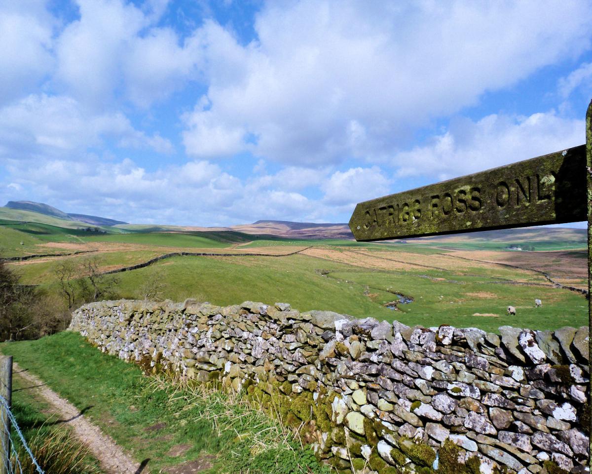
Back in Stainforth take the road opposite the Craven Heifer pub and turn left and then right towards a steep lane heading south east out of the village. Follow the lane uphill for half a mile to a shut gate. To the left a path leads downhill to Catrigg Force. The single drop waterfall is to the left through a small gate and in to the woods. To the right of waterfall gate is the top of the waterfall and a lovely little spot for a picnic. Return to the large gate and follow the farm track through a second gate and then to the right as it heads towards Higher Winskill Farm. As it passes the 2nd gate there is a little raised bitof land with a great view across all Three Peaks of Yorkshire.
From the outskirts of the farm head south east along the tarmacked track to a more main road, Turn right on the road and then after 100 metres left on to the open hillside. You are passing through glorious limestone scenery of pavements. Scars and the odd millstone grit boulder brought here by the ice age. The footpath passes a stile before meeting a farm track and a gate to the left. Go through the gate and turn right through a further stile to a path contouring the hillside with steep cliffs and Victoria Cave to the left and open country to the right. The path heads south for three quarters of a mile, dropping eventually to a non wooded dell at Attermire. The dell is surrounded by limestone cliffs and is a great spot. Turn right and after an awkward stile climb steadily with a wall on the left.
A gate at the col reveals views over Ribblesdale ahead. Settle is below you but it is a steep descent before joining the lane where you started the walk near the Co-op.
Fact File:
Distance: Roughly 7.5 miles. Height to Climb: 360m (1,180 feet).
Start: SD 818635. There is roadside parking in the linear village but a convenient lay by to the east end is best.
Difficulty: Moderate. Generally easy terrain on good paths or lanes but the limestone can be slippy when wet. Steep climb from Stainforth village to Catrigg Force.
Refreshments: Plenty of choice in Settle, a lovely market town.


Comments: Our rules
We want our comments to be a lively and valuable part of our community - a place where readers can debate and engage with the most important local issues. The ability to comment on our stories is a privilege, not a right, however, and that privilege may be withdrawn if it is abused or misused.
Please report any comments that break our rules.
Read the rules here