
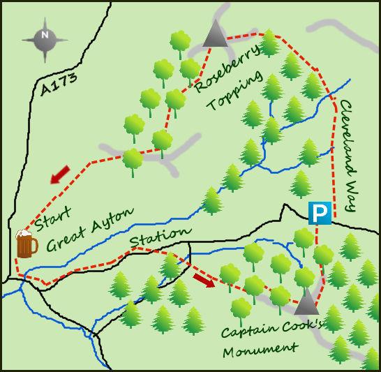
THIS walk combines two of the most iconic landmarks in the North York Moors; Captain Cook’s Monument and the instantly recognizable Roseberry Topping.
Perched on the banks of the River Leven, Great Ayton lies on the edge of the North York Moors National Park and has some excellent walks from its centre. There are plenty of parking places to the east of the village, take the road from the post office marked to the station. At the station cross the lines and almost immediately take the lane to your right. After 200 metres turn left on a path till it meets another lane over a stile, turn right and follow this up hill, till it arrives at Ayton Bank Woods. After entering via a gate follow the wall to your right till it meets a forest track left and follow this all the way to Captain Cook’s Monument.
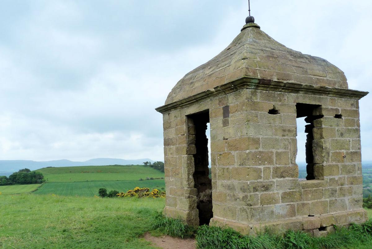
Erected in 1827 the monument stands an impressive 60 feet high and is built as a memorial to the great explorer and circumnavigater Captain Cook. A popular and admired figure both in his home area before he headed south and then to his fellow sailors on his adventures he was much mourned on his death. The monument stands on the clearing of Easby Moor, with some views available above the top of the forest. From the monument head for the forest track to the north and follow this for ½ a mile downhill to a road and parking area. You are now on the Cleveland Way and being a national trail is well signposted.
Carry on over the road and follow the Cleveland Way across the moor, still heading north. After three quarters of a a mile meet a stone wall, pass through and carry on east and downhill with the looming bulk of Roseberry Topping soon blocking out any sun. The hill is an unusual landmark in its prominence and shape. It may only be a 1,050 feet high but it is shaped like the Matterhorn (steep sided and pointy) in complete contrast to the flat moorland which surrounds it. It is a popular walk and many of the paths are paved for erosive protection, not something the young Captain Cook would have bothered about when he explored these slopes. From the bottom of the slope it is a 200 foot steep climb to the summit. The view is exten-sive and varied; from the North Sea to the housing estates of Tees-side and from the nearby forestry to the vast sprawling moors further afield. It is a good summit.
From the summit a path drops steeply down the slopes, initially south west and then south as it meets Newton Wood. Follow the path in the woods, bearing right so you continue downhill and turning in a westerly direction. Cross the railway, turn immediately left and follow a faint path in to the northern outskirts of Great Ayton.
Fact File:
Distance: Roughly 6.5 miles
Height to Climb: 350m (1,150 feet)
Start: NZ 563108. There is plenty of parking near the centre of Great Ayton and the Royal Oak.
Difficulty: Medium. The paths and lanes are very good but there is some short but steep climbs.
Refreshments: The Royal Oak is our pub of choice but there are other hotels and cafes in Great Ayton.
Be Prepared:
The route description and sketch map only provide a guide to the walk. You must take out and be able to read a map (O/S Explorer OL26) and in cloudy/misty conditions a compass. You must also wear the correct clothing and footwear for the outdoors. Whilst every effort is made to provide accurate information, walkers head out at their own risk.


Comments: Our rules
We want our comments to be a lively and valuable part of our community - a place where readers can debate and engage with the most important local issues. The ability to comment on our stories is a privilege, not a right, however, and that privilege may be withdrawn if it is abused or misused.
Please report any comments that break our rules.
Read the rules here