
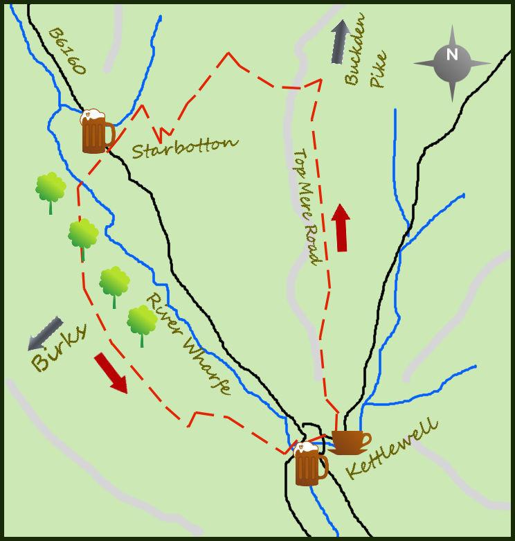
THIS circular walk from Kettlewell follows excellent bridleways (ie: no stiles!) on either side of the valley with great views and a pleasant break in Starbotton half-way through.
From the car park in Kettlewell pass the toilets to the Blue Bell and turn right past the pub. The narrow road goes through the village for 350m before bending sharply left and starting to climb steeply.
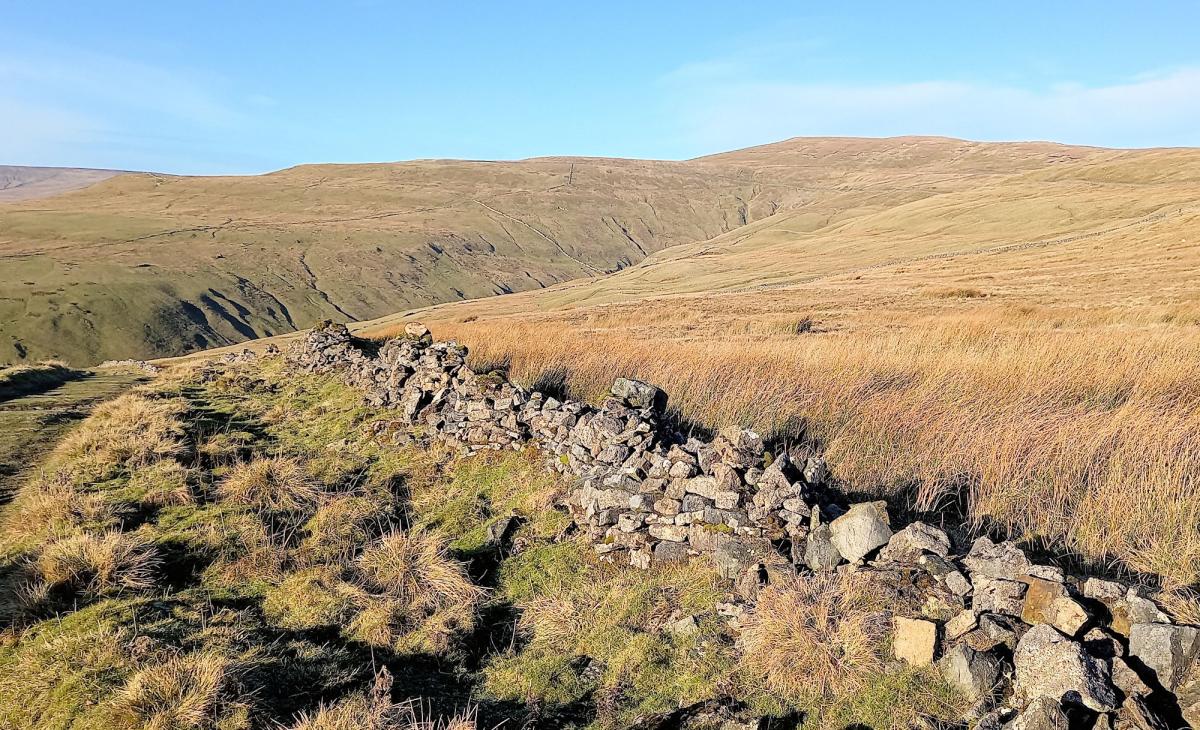
One hundred metres further, the road bends right, leave it for the obvious stony track straight ahead which heads up the hillside. This is Top Mere Road, a green lane used for centuries by farmers taking their sheep up and down the hills depending on the season. As a walker it climbs steeply initially, but soon becomes more gradual and the initial roughness eventually becomes grassier and easier underfoot.
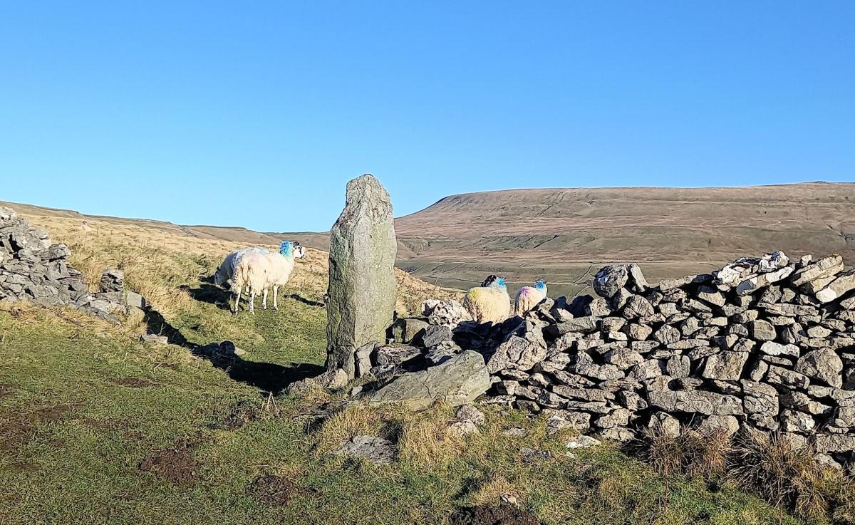
Pass through three gates on the two-mile climb. The excellent views to the right are of Great Whernside and it is worth stopping and looking at the views behind you down Wharfedale. On arrival at a large finger sign and a meeting of paths, turn left to Starbotton. Directly ahead is a faint path which eventually leads to the summit of Buckden Pike, but not today. The route to Starbotton is downhill on another very well-maintained bridleway. Initially open, after two gates it becomes more of a lane. As the path drops there are good views to Buckden Pike on your right and directly ahead to Upper Wharfedale and the long shoulder of Birks. The track gradually descends in to Starbotton, becoming steeper nearer the village.
In Starbotton the Fox and Hounds is open all days except Monday/Tuesday (winter only) and makes for a lovely break in the walk. Make for the south side of the village on the main road and just before leaving a track is signposted to the right leading towards a narrow footbridge crossing the River Wharfe. Continue on the footpath opposite the bridge (narrow in places) that heads towards the hillside and on bearing left into woodland. The path climbs diagonally up the steep slope and after 300m emerges on the open fellside. The main problem on the climb is a felled tree across the path, the legacy of a recent storm.
As the slope becomes less steep the path divides, take the one to the left and continue walking nearly level along the open countryside.
After circling Moor End Farm (well signposted) the views become very impressive down to Kettlewell but also both upper and central Wharfedale are very well see.
The U-shaped valley most impressive, a geographer’s dream. The wide track then descends towards Kettlewell arriving at its west end. Cross the bridge and return to the car (or a pint).
Fact box:
Distance: Roughly 6.5 miles
Height to Climb: 490m (1,610 feet)
Start: SD 968722. There is a large national park car park with toilets and a café opposite.
Difficulty: Moderate. The tracks are obvious and none too steep and there are no stiles!
Refreshments: The Racehorses is presently closed but there are two other good pubs and two cafes in Kettlewell.
Be Prepared: The route description and sketch map only provide a guide to the walk. You must take out and be able to read a map (O/S Explorer 30) and in cloudy/misty conditions a compass. You must also wear the correct clothing and footwear for the outdoors. Whilst every effort is made to provide accurate information, walkers head out at their own risk. Please observe the Countryside Code and park sensibly.
Jonathan Smith runs Where2walk, a walking company in the Yorkshire Dales:
- He has published 2 books on walks in the Dales, ‘The Yorkshire 3 Peaks’ and ‘The Dales 30’ mountains. Available direct from the Where2walk website.
- Book a Navigation Training day (Beginners or Intermediates) in 2022. Dates and information on the website.
- Where2walk also run Navigation weekends in the Dales and the ‘3 Peaks in 3 Days’ guided walks. Full details also on the website
Jonathan’s popular website, Where2walk.co.uk also features 100’s of walks across Yorkshire and beyond, from easy strolls to harder climbs


Comments: Our rules
We want our comments to be a lively and valuable part of our community - a place where readers can debate and engage with the most important local issues. The ability to comment on our stories is a privilege, not a right, however, and that privilege may be withdrawn if it is abused or misused.
Please report any comments that break our rules.
Read the rules here