
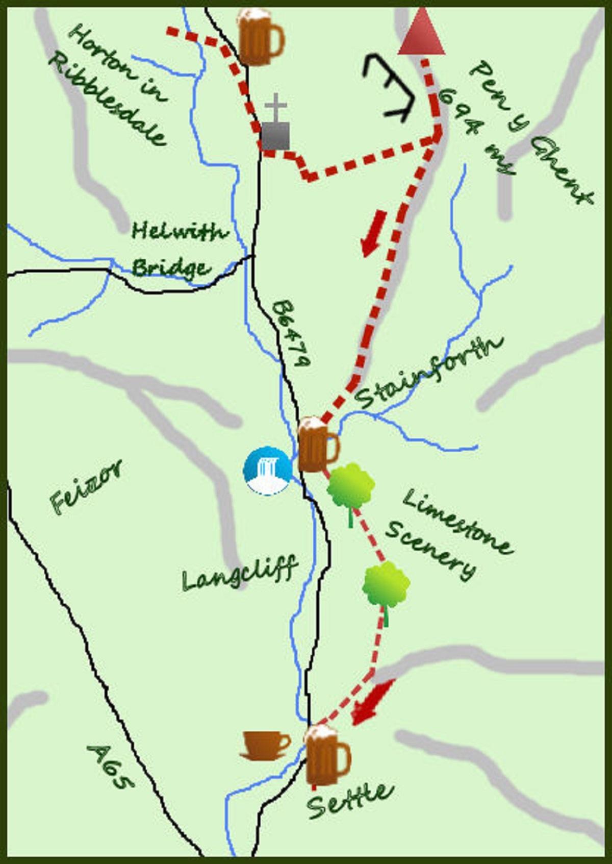
THIS is a one-way walk accessible via the wonderful Settle to Carlisle railway.
The walk described takes in Pen-y-Ghent, one of the Yorkshire Three Peaks, before completing along the Pennine Bridleway with some cracking views over Ribblesdale.
The train from Settle leaves at roughly one-and-a-half hour intervals for Horton (check the latest times) and takes 10 minutes.
From the station head down the main street, turning sharp right over the river and towards the presently closed Three Peaks café. From the café head south towards the church, take the path through the field just before the church and then cross the river and continue up the lane, past the old school to Brackenbottom Farm. Turn left and pass through a small gate.
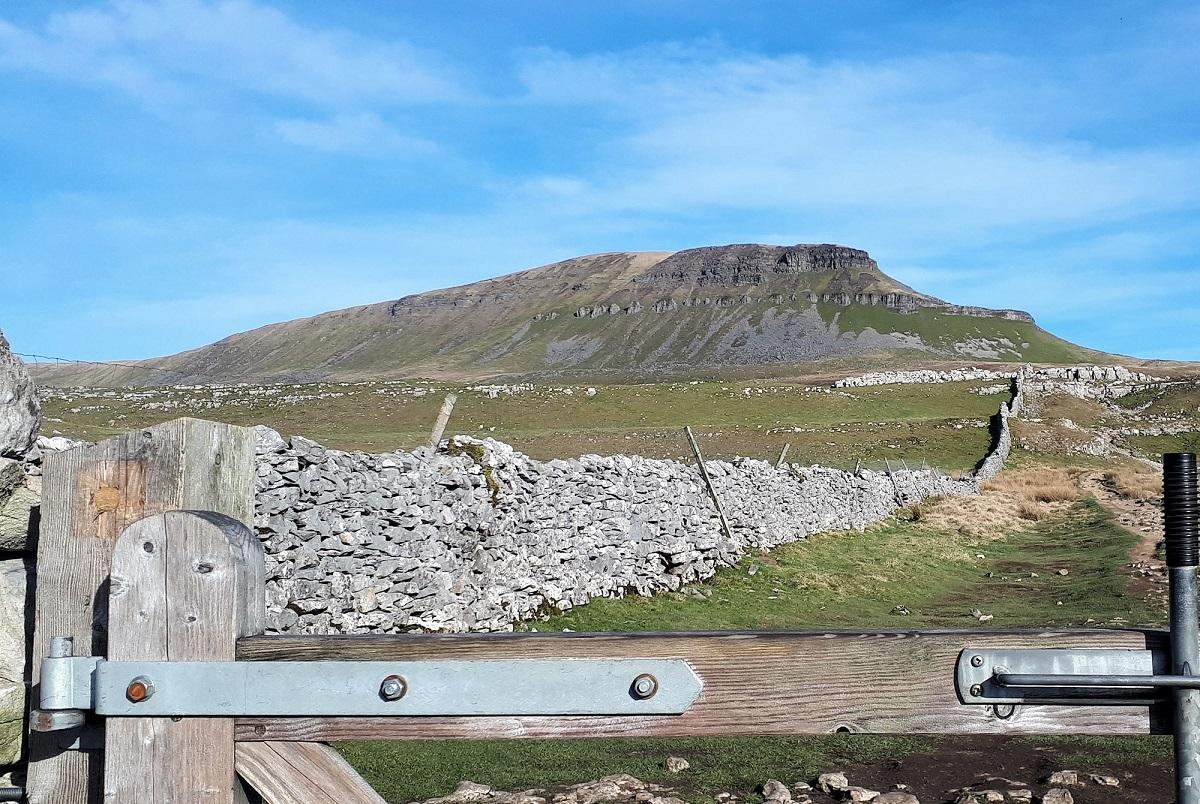
The route up Pen-y-Ghent is clear and obvious from here, initially via a steep rolling climb along an eroded, partially repaired path and then at the gate in the wall turn left and climb steeply up to the summit. The climb is rocky with a mild scramble near the top. From the summit return to the hole in the wall.
Carry on south along the Pennine Way for three quarters of a mile to a farm track, the Pennine Way goes left but you should go right and follow the lane for a further 300 metres to a gate at the boundary wall and take the footpath heading just west of south. The footpath crosses a number of walls but keeps its height for three quarters of a mile with excellent views ahead.
At a junction of walls (marked as a sheep wash on the O/S map) bend more south westerly and start to drop steadily downhill to a lane. Cross the lane (this is the Pennine Journey long distance path) and follow the broad track in to the lovely village of Stainforth.
It is quite possible to cross under the railway line and road at the car park in Stainforth to join the riverside route at Stainforth Falls (a good spot), but I prefer the footpath that heads just east of south (cross the river at the Craven Heifer pub and turn right), which climbs steadily past spectacular Stainforth Scar and past Low Winskill Farm.
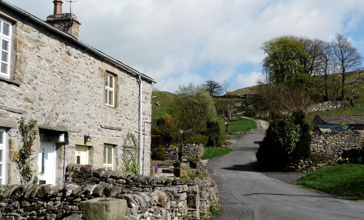
From the farm the walk along the road is through spectacular limestone scenery and nearly flat. Where the road turns sharply right to drop in to Langcliffe carry straight on along the marked footpath, in essence skirting the hillside as you track towards Settle.
The views over the Ribblesdale and the Forest of Bowland more than compensate for any initial climb.
At a laithe barn and gate the track drops steeply in to Settle.
The sketch map also shows a low level route from Horton to Settle which sticks close to the River Ribble all the way.
Fact file:
Distance: Roughly 10.5 miles
Height to Climb: 650m (2,130 feet)
Start: SD 808727. From the train station at Horton walk down the road, past the car park to the 3 Peaks cafe.
Difficulty: Hard/Medium. The walk over Pen y Ghent to Stainforth is over some rough ground and hard but the riverside, lower level walk is never too difficult
Refreshments: Settle has some lovely pubs and I particularly like a pint in the Talbot.
Be Prepared: The route description and sketch map only provide a guide to the walk.
You must take out and be able to read a map (O/S Explorer OL2) and in cloudy/misty conditions a compass. You must also wear the correct clothing and footwear for the outdoors.
Whilst every effort is made to provide accurate information, walkers head out at their own risk.
Jonathan Smith runs Where2walk, a walking company in the Yorkshire Dales. Jonathan has written his own book, the Dales 30 which details the highest mountains in the Dales. He also runs one-day navigation courses for beginners and intermediates. Join his Learn a Skill, Climb a Hill weekends in the Dales. To find out more details on any of the above visit his website, where2walk.co.uk


Comments: Our rules
We want our comments to be a lively and valuable part of our community - a place where readers can debate and engage with the most important local issues. The ability to comment on our stories is a privilege, not a right, however, and that privilege may be withdrawn if it is abused or misused.
Please report any comments that break our rules.
Read the rules here