

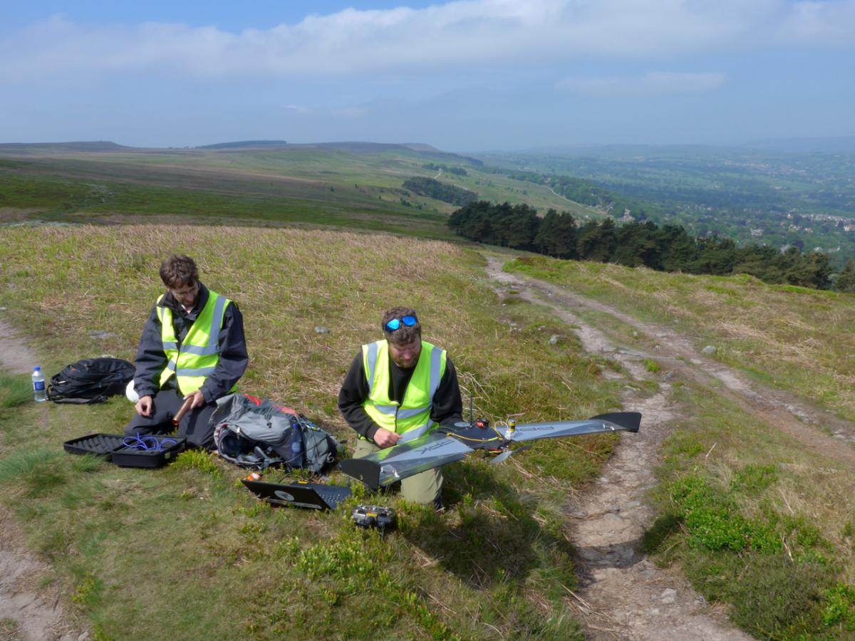
AN aerial photographic survey of Ilkley moor took place on Thursday using a fixed winged drone flying at 400ft above the moor.
In ideal flying conditions and taking 11 hours to complete, the drone criss-crossed the moor 80 times covering almost 100 miles and taking over 8,000 overlapping digital photographs. QuestUAV who carried out the survey said that the moor was the largest area they had ever flown in a single day. The photos will be ‘stitched’ together to make both full vertical and 3D images of the moor.
Commissioned and funded jointly by Friends of Ilkley Moor and Bradford Council Countryside Service the survey is part of the Heritage Lottery funded Big Ilkley Moor Survey managed by the Friends of Ilkley Moor.
Ian Condliffe of the Friends said that the photography will help create a baseline map of main habitats and vegetation types on the moor, focussing particularly on the wetter areas. He added: "The high resolution of the photos and digital technology available these days will allow us to look at the photos using different light wavebands which will help identify and map the many smaller watercourses and footpaths on the moor. We also hope that computer software will enable young trees to be identified, mapped and counted automatically so that we can monitor what appears to be a growing number of trees on the moor’s lower slopes."


Comments: Our rules
We want our comments to be a lively and valuable part of our community - a place where readers can debate and engage with the most important local issues. The ability to comment on our stories is a privilege, not a right, however, and that privilege may be withdrawn if it is abused or misused.
Please report any comments that break our rules.
Read the rules here