

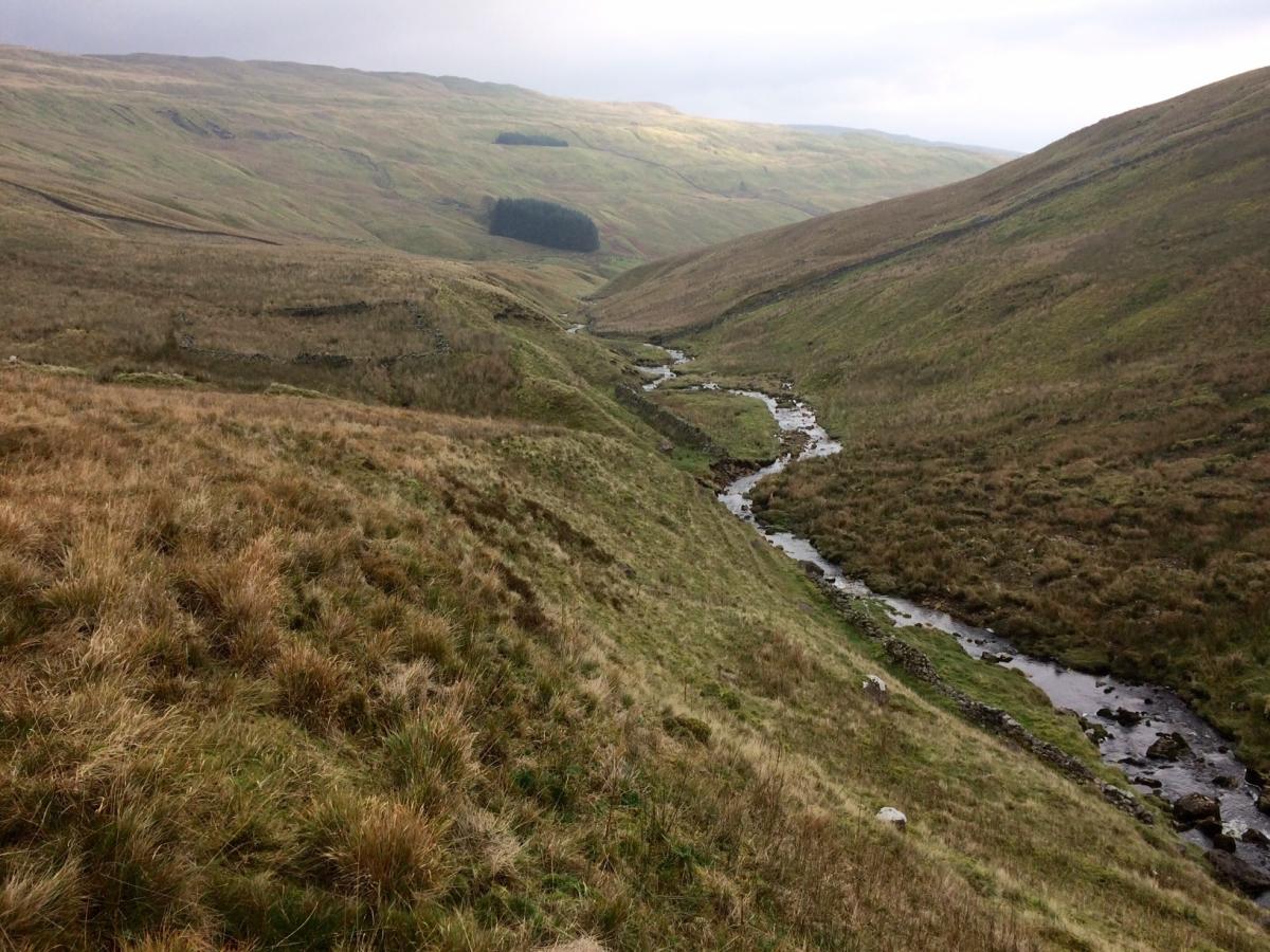
THIS walk is a real hidden delight, says Lesley Tate. A narrow road from Stainforth takes you to the start point at the hamlet of Halton Gill, where a road continues along to Foxup, where it just stops. The walk itself, follows a route never far from either the River Skirfare, or Cosh Beck, and takes in some really isolated, yet stunning countryside. The walking is pretty easy, there are no great climbs, but if there has been a lot of rain, the ground will be boggy - as when I did it, and the path back from Cosh, can be a bit hairy.
Step by step:
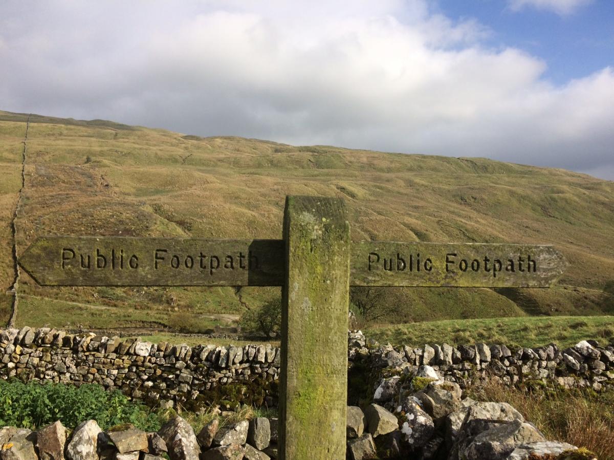
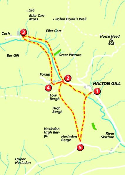
1. From the hamlet of Halton Gill, walk back the way you came towards Stainforth, cross over road bridge over River Skirfare and immediately after, take footpath on right. Drop down and follow path, which stays close to the left of the river. Follow the path until it comes to some farm buildings at Foxup Bridge. Path goes to the right of the farm.
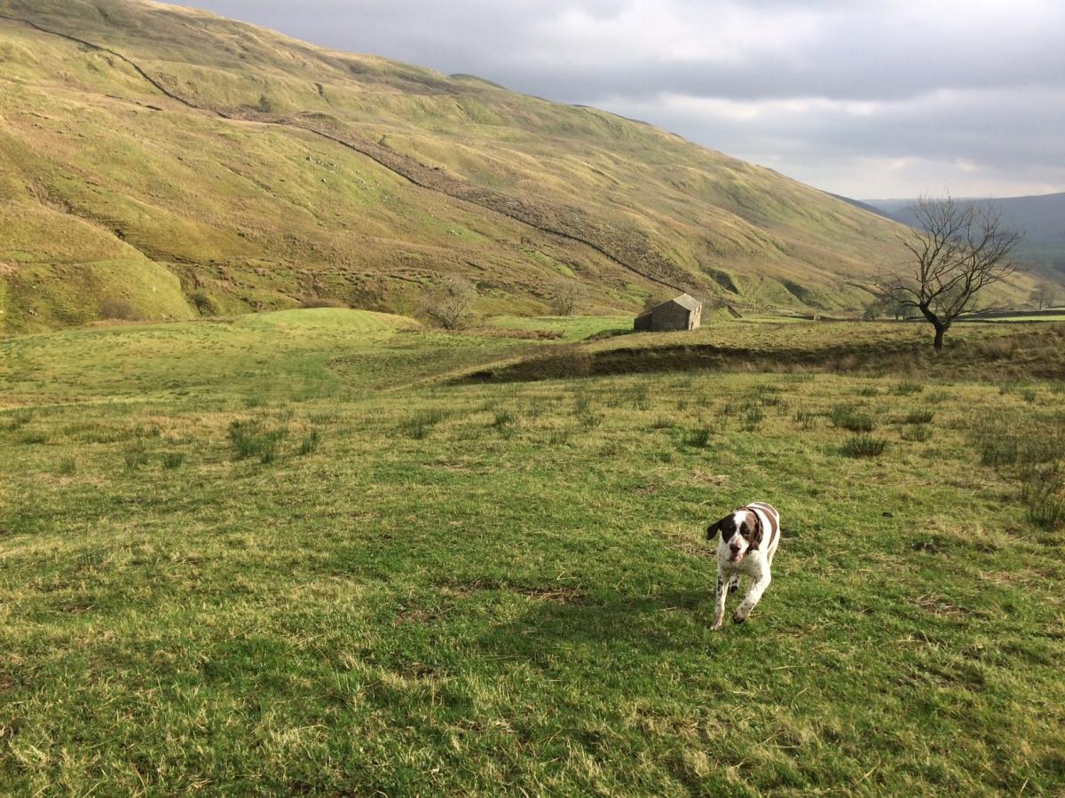
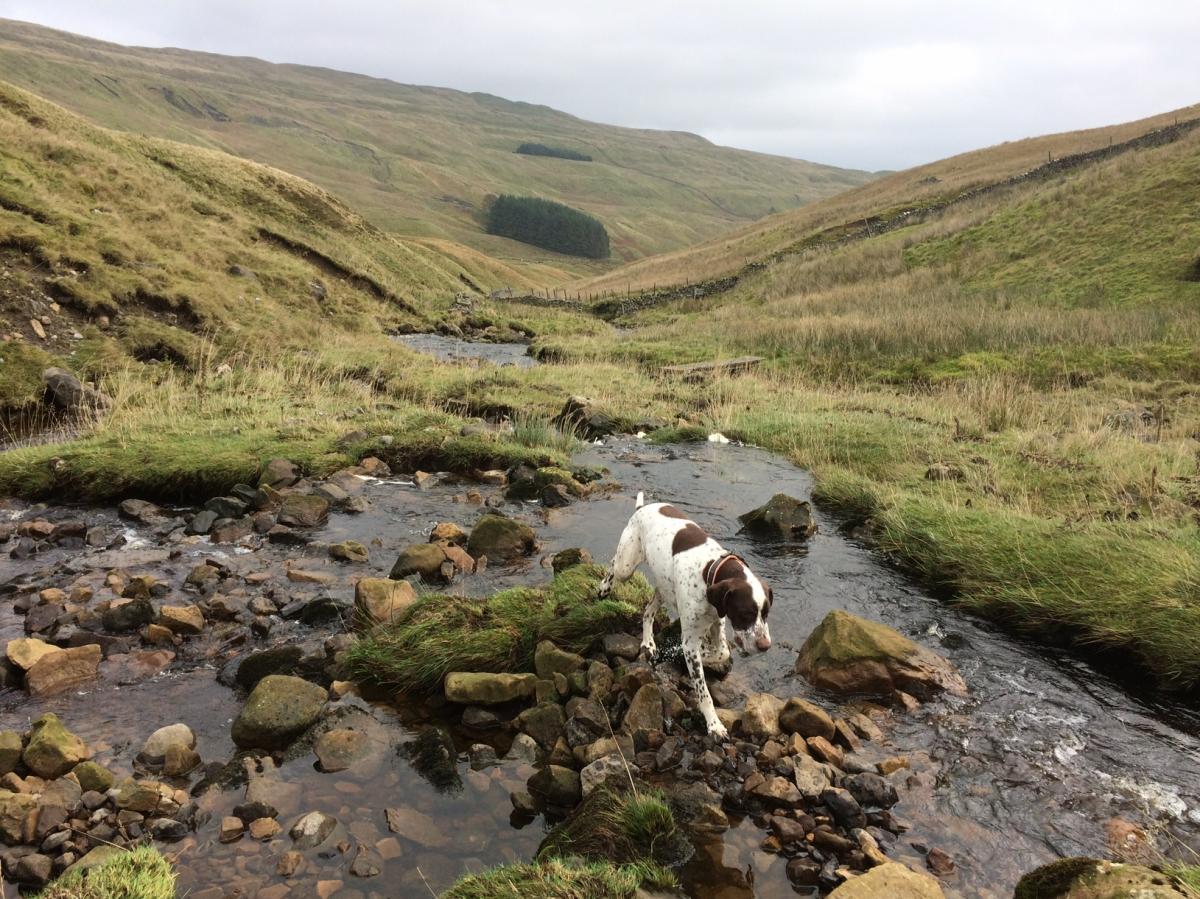
2 Take track marked to Cosh, one and three-quarter miles. Stay on the farm track, with the ever dwindling Skirfare now on your left, ignoring a footpath that goes off to your left. Track winds its way across moorland and eventually comes to the isolated farm at Cosh.
3 Take marked footpath to Foxup off to left. Footpath more or less disappears, but roughly runs to left of Cosh Beck - which will eventually become the Skirfare, carry along to side of beck, heading back in the general direction you have come. After about half a mile, cross bridge over beck and head for the first of a series of wall gates. The path gradually moves away from the beck, now on your left, and passes a few stone barns and more wall stiles until you come out at Foxup and onto a lane.
4 Turn left along the lane, and after a short way, take the bridlepath to Horton in Ribblesdale, opposite Foxup Bridge Farm. The track is pretty clear here, and climbs quite steeply uphill before levelling out and coming into open moorland, you will eventually see Halton Gill down to your left. Ignore a track that leads down to Halton Gill, and stay straight ahead, passing a small limestone pavement on your left, and coming out on the road into Halton Gill. Left along the road, and back to the start (5).
Factfile:
Location: Littondale, Yorkshire Dales National Park
Distance: seven miles, 11 km, allow three hours
Steps: 14,900; Floors: 80
Difficulty level: Moderate - depending on time of year, and weather conditions
Livestock: Plenty of sheep, dogs will need to be kept under close control, and do remember to clean up after them.
Parking: A small parking area at Halton Gill, where there is an honesty box charge, and also a tearoom.
OS Map: OS 98 Wensleydale and Upper Wharfedale


Comments: Our rules
We want our comments to be a lively and valuable part of our community - a place where readers can debate and engage with the most important local issues. The ability to comment on our stories is a privilege, not a right, however, and that privilege may be withdrawn if it is abused or misused.
Please report any comments that break our rules.
Read the rules here